
 KIMT News 3
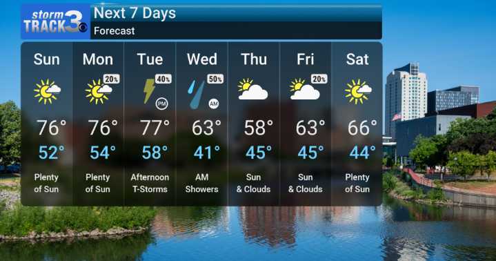
We've got a beautiful weekend ahead for much of southeast Minnesota and northeast Iowa. Expect mostly dry weather through the weekend, with seasonable temperatures in the mid to upper 70s. There's a small, isolated chance of a shower or storm popping up, especially in the afternoons, particularly for areas west of I-35. We might see some patchy fog in low-lying areas and river valleys, particularly Sunday morning, so use caution if you're out and about early.
Looking ahead to Monday, the forecast shows us a slight increase in shower and thunderstorm chances. It will otherwise be party cloudy. However, we're tracking a more significant change as we head into the middle of the week. A strong cold front is set to move in late Tuesday into early Wednesday. This system brings with it a decided

 Local News in New York
 KRIS 6 News Weather
 FOX 10 Phoenix National
 KPTV Fox 12 Oregon
 Boston.com News
 FOX 5 Atlanta Crime
 AlterNet
 Press of Alantic City Business