
 ABC4 News
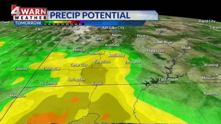
SALT LAKE CITY (ABC 4) - High pressure will keep us very warm and dry through midweek but look for slowly decreasing temperatures by the end of the week with increasing scattered storm chances into the weekend.
Happy Tuesday, Utah! Our Tuesday afternoon will bring more sunshine across most of northern Utah, with a few extra clouds building across far southwest Utah. While most of us will remain dry on our Tuesday, SW Utah will begin to see a few pop-up afternoon showers developing.
These will be few and far between, but the chance will be there for the afternoon and evening hours. High temperatures will remain above average with low to mid 90s for the Wasatch Front. Highs will still be around 100 for southwest Utah.
Moisture will begin to ramp up across southern Utah on Wednesday with i

 Deseret News
 KSL 5 TV
 KSL NewsRadio
 US Magazine
 Slate Politics
 Local News in California
 Daily Kos
 America News
 The Columbian Sports
 The Daily Beast