
 New York Post
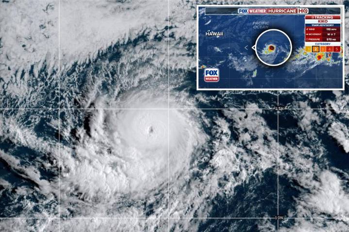
Hurricane Kiko continues to intensify in the eastern Pacific Ocean as it treks toward the west in the general direction of Hawaii, but at this point, it is not expected to bring major impacts to the islands.
As of Wednesday, the National Hurricane Center reported that the nearly Category 3 hurricane was approximately 1,665 miles east of Hilo, but dry air and cooler water temperatures were expected to act as a significant barrier between the cyclone and the islands.
NWS forecasters in Honolulu noted that cyclones often weaken as they approach the islands due to cooler waters and wind shear.
Forecast models suggest that the cyclone will make its closest approach to Hawaii late next week, but the exact impacts, whether it is an increase in shower activity or heightened waves, remain to be

 KTVB 7
 FOX Weather
 KPTV Fox 12 Oregon
 CBS Boston
 1011 Now Lincoln
 WAVE 3 News
 Deadline
 The Fashion Spot
 NBC Southern California Entertainment