
 NBC 6 South Florida
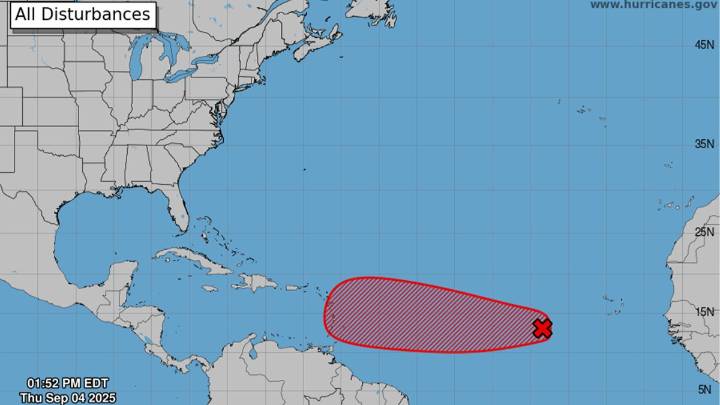
In the week preceding the historical peak date of the Atlantic hurricane season on Sept. 10, our attention turns to Invest 91L.
The term “Invest” may be familiar to residents in hurricane-prone areas. It means that a tropical disturbance merits investigating further. To do so, the National Hurricane Center (NHC) activates specialized weather forecast models designed to provide guidance regarding the future track and intensity of the system. And if the fledgling storm is within fuel range, hurricane hunter planes will provide reconnaissance.
This particular Invest — 91L — originated as an easterly wave over the African continent and moved into the Atlantic waters south of Cabo Verde at the beginning of the week. Since then, it’s been showing signs of very slow development. A low-pressur

 MassLive
 CBS News
 FOX Weather
 Hawaii News Now
 FOX 10 Phoenix Latest
 CBS Sacramento CBS13
 Raw Story
 WVTM 13 Sports
 New York Post Video
 Seeking Alpha Stock