
 WLKY
WLKY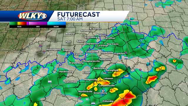
LOUISVILLE, Ky. —
Another round of impact weather is likely to move across the WLKY viewing area Friday night and Saturday morning.
While much of Friday will feature dry and warm conditions, yet another cold front is expected to roll through the region late-day Friday into the night.
Hearst Owned Futurecast Noon Friday
As the front moves through, a scattering of showers and a few thunderstorms can be expected.
One batch of scattered storms looks like it will try to develop over south central and eastern Kentucky (mainly south of the Louisville area) late Friday afternoon into the early evening.
Hearst Owned Futurecast 7PM Friday
Hearst Owned Futurecast 10PM Friday
Some of these storms could be on the strong side with the greatest risk being south and east of the Parkways.
He

 Courier Journal
 WBKO
WBKO CBS News
 WNKY
WNKY WAVE 3 News
 AlterNet
 New York Post