
 WJZ CBS Baltimore
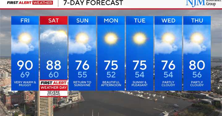
We've issued a First Alert Weather Day for Saturday afternoon as a strong cold front sweeps into Maryland, bringing the chance for strong to severe thunderstorms that could impact the Baltimore metro area.
Storm Timing and Threats
Storms are expected to develop to our west by midday, then move into the Baltimore area between about 3 and 8 p.m. This means the late afternoon and early evening commute, as well as early Saturday night plans, could be disrupted. These storms will be fast-moving but could pack a punch.
The main hazard will be damaging wind gusts strong enough to knock down trees, power lines, and outdoor structures. A few storms could also produce hail. While the setup is not favorable for tornadoes, we can't rule out a brief, isolated spin-up in any stronger cell.
Northeast

 Charleston Gazette
 Tucson News Now
 Corpus Christi Caller-Times
 WKOW 27
 FOX Weather
 The Weather Channel
 The Bay City Times
 KTAL-TV
 New York Post
 NewsTalk 1280
 Iron Mountain Daily Sports