
 KWWL
KWWL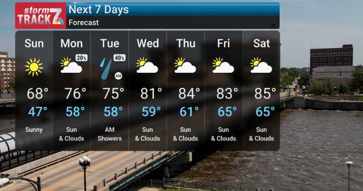
We'll start the period out with some cooler temperatures than we've become accustomed to, with highs generally in the 60s again tomorrow Sunday. This is a result of a high-pressure system building in from the northeast, which should give us plenty of sunshine and light winds as it settles overhead through tonight and Sunday. This system will allow temperatures to take a dip, especially early Sunday morning. We're tracking the potential for overnight lows to drop into the upper 30s across parts of northern and western Iowa, which is certainly on the cooler side for this time of year.
However, don't get too used to that chill! By Monday, we expect a warmer trend to commence. We'll start to see southerly winds return, bringing warmer air back into the region, with highs climbing back into th

 Local News in New York
 NECN Providence
 KPTV Fox 12 Oregon
 The Washington Post
 FOX 5 Atlanta Crime
 WTOP
WTOP FOX Weather
 KSNB Local4 Central Nebraska
 America News