
 The Garden Island
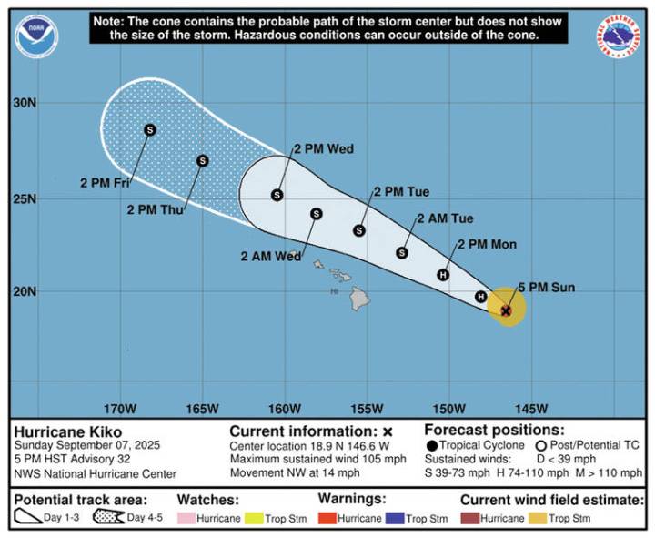
As of 5 p.m. Sunday evening, Kiko was located about 555 miles east of Hilo and about 750 miles east of Honolulu. The hurricane was moving at near 14 mph with maximum sustained winds of 105 mph.
Kiko is expected to pass north of the main Hawaiian Islands Tuesday and Wednesday. Kiko is forecast to become a tropical storm late Monday or Monday night.
“While the risk of direct impacts on the islands appears to be decreasing, interests there should continue to monitor Kiko’s progress and the latest forecast,” according to the forecast.
Hurricane-force winds extend outward up to 30 miles from the center, while tropical-storm-force winds extend outward up to 90 miles.
There are no coastal watches or warnings in effect.
Although there are no Kiko-related advisories covering land in the island

 Associated Press US News
 KPBS News
 AccuWeather Severe Weather
 Los Angeles Times
 The Weather Channel
 CBS Boston
 The Gleaner
 WCNC Charlotte Weather
 The radio station 99.5 The Apple
 Raw Story