
 TMJ4 News
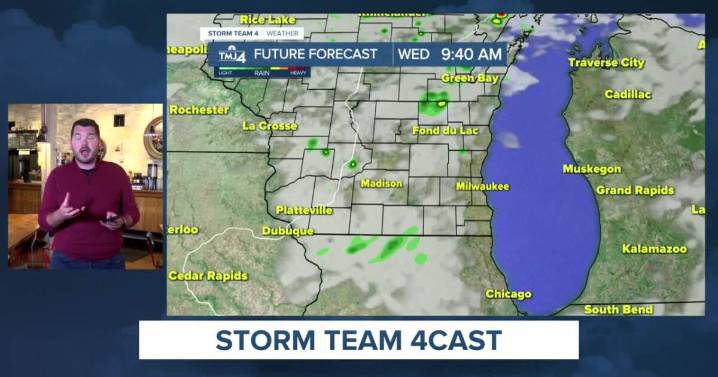
Overnight showers and storms on the Plains have tossed cloud cover over parts of the Midwest. Most of today’s rain in Wisconsin will fall well north of southeast Wisconsin. However, a few stray showers may wander into the region late tonight and early Wednesday morning.
Southeast Wisconsin weather: Late summer warm-up
While many see sunshine early today, cloud cover will increase throughout the day. Highs will top out in the mid-70s.
Showers will be quite spotty first thing Wednesday. Sunshine returns for the afternoon as highs remain in the mid-70s.
Warmer air continues to surge into Wisconsin late in the week. Highs jump from the mid-70s on Thursday to the upper 70s to near 80 by Friday and Saturday.
Storm Team 4 is monitoring the potential for a few showers to roll in on Saturday.

 Florida Today
 FOX 13 Tampa Bay Crime
 Eyewitness News 3
 Times Herald
 WABI
WABI Ionia Sentinel-Standard
 News 19 WLTX
 KMVT
KMVT PC World Business