
 ABC4 News
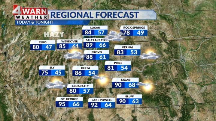
SALT LAKE CITY (ABC4) — Happy Tuesday, Utah! Today's weather will be a case of rinse and repeat with daytime highs reaching the upper 80s on the Wasatch Front, low to mid 80s for valleys in southern and central Utah, and low to mid 90s for the normally hot spots. Healthy southerly winds are helping keep those warmer temperatures locked in. Moisture is still present and will spell a mix of sun and clouds across the state. A brief isolated shower or thunderstorm is possible on the Wasatch Front, but the best chance will be in higher terrain and in the northeast quadrant of the state north of I-70. Isolated thunderstorms are expected in Castle Country, the Uinta Basin and Mountains, and possibly the Wasatch Back.
Wednesday will be similar with highs in the upper 80s again for the Wasatch Fro

 The Daily Beast
 AlterNet
 Raw Story
 Washingtonian
 Seeking Alpha Stock
 Vogue Runway
 Mediaite
 NBC News MLB