
 WEVV 44News
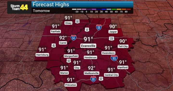
Currently, an axis of high pressure is positioned directly overhead which is contributing to these consistently warm conditions and sunny skies. Looking ahead into the week, we expect this ridge of high pressure to continue dominating through Wednesday. This means continued above-normal temperatures, with highs consistently in the 90s.
As we move past Wednesday, we'll see a shift in the upper-level pattern. Troughing is expected to increase, which typically brings cooler temperatures and more chances for rain. By late week, specifically Thursday into Friday, we're forecasting an increase in moisture and instability, leading to scattered showers and thunderstorms developing. We're seeing indications of a 20-40% chance of rain by Thursday and Friday, with those lingering chances possibly ex

 Nicki Swift
 People Top Story
 LiveNOW from FOX Entertainment
 MENZMAG
 Raw Story