
 ClickOrlando
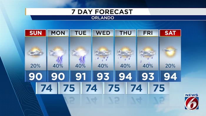
ORLANDO, Fla. – If you had a chance to look at the radar today, you probably closed your app within that very same second. If you aren’t one to look at a weather radar, at least when you’re out and about here in Central Florida, don’t fret – you didn’t miss much.
Dry air has overtaken the state from up north. High pressure is draped across the eastern side of the Appalachian mountains to our north, with its reach extending across our peninsula. Spot the corridor of browns and black shading, indicating the slug of dry air extending southwestward from high pressure stuck up against the east coast of the US (Copyright WKMG 2025)
This has upped our temperatures some, and especially increased some of the humidity where we can feel it down at ground level. But as soon as you ascend above w

 FOX Business
 Gossip Cop
 CBS4 Miami
 CourierPress Sports
 NPR
NPR ABC 7 Chicago Sports
 America News
 The Washington Informer