
 KICKS 105
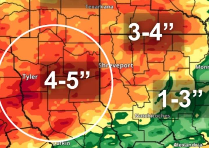
The Storm Prediction Center has placed much of East Texas in a marginal risk area for severe weather on Wednesday, September 24. A boundary separating very warm, humid air from slightly cooler, drier air is expected to kick off showers and thunderstorms across the eastern third of Texas on Wednesday. The biggest severe weather threat will come from damaging thunderstorm winds exceeding 50 mph. Forecasters do not expect tornadoes or hail to be issues.
The marginal risk of severe weather across Texas extends from southwest Texas through the metros of Austin, San Antonio, and Houston, and northward through the Ark-La-Tex.
VIDEO: Tornado Doesn't Stop Buc-ee's Customers From Pumping Gas
Threat of Isolated Flooding
Rainfall amounts between an inch and two inches could be commonplace, esp

 AccuWeather Severe Weather
 KPTV Fox 12 Oregon
 KTVU San Francisco
 KGNS
KGNS KRIS 6 News Weather
 WFMJ-TV Entertainment
 ABC10 Video
 CBS Colorado