
 WAFB
WAFB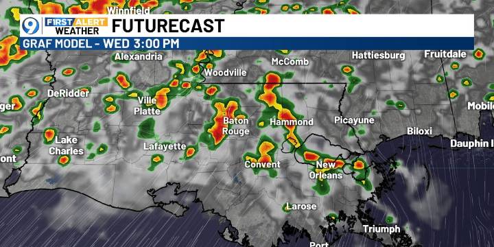
BATON ROUGE, La. (WAFB) - Good rain and storm chances arrive today ahead of a cold front and will linger into Thursday morning. Once the front passes, drier and more comfortable conditions move in to wrap up the workweek and weekend.
TODAY’S FORECAST
A few isolated showers are possible this morning, but rain and storms will become more widespread from late morning through the afternoon. Before storms develop, highs will reach the upper 80s and low 90s.
SEVERE WEATHER THREAT TODAY
A Level 1 out of 5 (Marginal Risk) of severe weather is in place through early Thursday. The main concern will be damaging winds with the strongest storms.
BEHIND THE FRONT
After the front moves through, drier and less humid air will filter in. Highs will settle into the mid to upper 80s, with lower humidity

 KSLA News Crime
 The Advocate
 NOLA
NOLA KPLC
KPLC