
 WDHN News
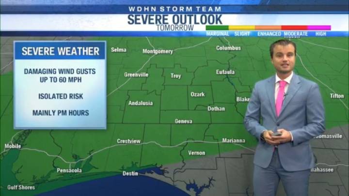
DOTHAN, Ala. (WDHN) — Our warm and dry pattern is coming to an end soon!
The pattern shift comes as a cold front arrives to our area Thursday, increasing our rain chances, but also bringing an isolated severe weather risk.
Ahead of that front, we will warm up quickly, with highs topping out in the mid-90s areawide. "Feels like" temperatures will be in the upper 90s and near 100 degrees.
We will remain dry to mostly dry for the next 24-36 hours before storms develop Thursday afternoon. This will come in the form of a semi-line of storms and a few cells.
Heavy rain, frequent lightning, and wind gusts up to 50 mph are the main possible hazards.
One or two storms could become marginally severe, producing damaging wind gusts up to 60 mph.
Heavy rain is possible into Friday before the fron

 Alabama Local News
 CBS News
 The Columbian Life
 Raw Story
 Vanity Fair
 OK Magazine
 Newsweek Video
 Associated Press US and World News Video
 AlterNet