
 WVEC
WVEC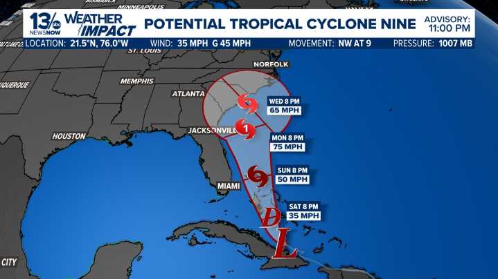
NORFOLK, Va. — Satellite images and surface observations suggest that Invest 94L is gradually organizing and beginning to develop a low-level circulation near eastern Cuba.
Although the system does not meet the criteria of a tropical cyclone currently, it is expected to become one during the next day or so. In addition, the system is likely to bring tropical storm conditions to portions of the central and northwestern Bahamas this weekend and potential impacts to portions of the southeast U.S. early next week.
SEE ALSO: 13News Now Hurricane Guide
The government of the Bahamas has issued a Tropical Storm Warning for the central Bahamas and a Tropical Storm Watch for portions of the northwestern Bahamas.
Strengthening of Potential Tropical Cyclone Nine is likely to be slow in the short

 FOX 10 Phoenix National
 FOX 13 Tampa Bay Crime
 CBS News
 Scottsdale Independent
 The Greenville News
 The Daily Beast
 5 On Your Side Sports
 Crooks and Liars