
 WYFF News 4
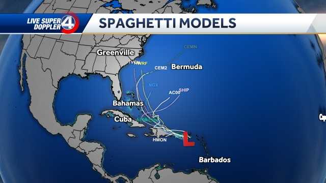
The models at 11 a.m. Saturday continue to show fewer impacts to the Carolinas from Potential Tropical Cyclone Nine.
Hurricane Stats
Beginning Friday night and continuing through 11 a.m. Saturday, the tropical models show Imelda being pulled out to sea before making landfall, due to Humberto rapidly growing in strength.
Hurricane Track
Coastal impacts:
Coastal areas will see large swells and strong rip currents, which will be the greatest impacts currently. With the storm moving away from the coast, winds look to be 30-45+ mph and heavy rain. Models vary on coastal rain totals from 3-5"+.
Upstate impacts:
Locally, the winds look much weaker. We could feel gusts 20-30 mph. The highest rain totals stick near the I-77 corridor could be between 2-4 inches. The GFS and EURO have rain tot

 ABC11 WTVD
 Associated Press Top News
 Associated Press US and World News Video
 Sarasota Herald-Tribune
 WRAL News
 WABI
WABI FOX 10 Phoenix Latest
 Arizona's Family
 WYFF Greenvile
 Just Jared