
 Savannah Morning News
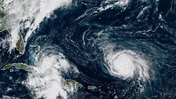
Soon-to-be Imelda, now Tropical Depression 9 (TD-9), is slowly but surely approaching the East Coast at 35 miles per hour. While not much has changed in its forecasted path since yesterday, National Weather Service (NWS) models show higher chances of the upcoming storm moving offshore.
"There's tremendous amounts of uncertainty, but here's been more and more model trending that shows this system slowing down and potentially turning back away from us," said NWS meteorologist Ron Morales in an 11:30 a.m. briefing on Sept. 27.
A slower storm, however, could also mean a stalled storm.
Depending on how far it is from the coast, a stalled storm would result in heavy rainfall and wind impacts. In the next seven days, the NWS projects the highest amounts of rain east of I-95, with up to 10 inch

 ABC11 WTVD
 Associated Press Top News
 Associated Press US and World News Video
 Detroit News
 Sarasota Herald-Tribune
 The Babylon Bee
 WABI
WABI Ocala Star-Banner
 WRAL News
 America News