
 Hawaii News Now
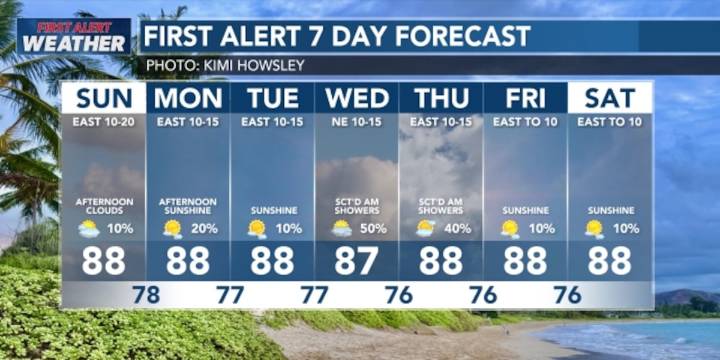
HONOLULU (HawaiiNewsNow) - More typical trade wind weather will become established over the islands over the next few days. There’s still a chance for afternoon leeward clouds and isolated showers, but more stable conditions are expected by Monday, with clouds and showers once again favoring windward and mauka areas during the overnight and morning hours.
There’s a First Alert for an interruption in this weather pattern around midweek, when a remnant frontal moisture band will get picked up in the trades will bring a brief increase in shower coverage. Trades may also become lighter close to the upcoming weekend.
In surf, a medium to long-period south swell will hold through the weekend with sets around 4 to 6 feet. North shore waves will decline as a north-northeast swell fades. Surf alo

 Santa Maria Times Safety
 FOX 5 Atlanta Crime
 Associated Press Top News
 CNN Climate
 KSNB Local4 Central Nebraska
 Arizona Republic
 Ocala Star-Banner
 FOX 10 Phoenix Latest
 Raw Story