
 The Grand Rapids Press
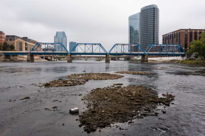
When you drive over a river now you might think that river is very low. You are probably correct. Let’s see just how low many Michigan rivers are right now.
The U.S. Geological Survey (called the USGS) monitors many of Michigan’s rivers for water flow and water levels through river gages and stream gages.
Jason McVay, Supervisory Physical Scientist with the USGS, says the gages are installed at key spots on rivers. The USGS tries to find a deeper spot on the river so they can accurately measure the river flow and water level through the highs and lows of river level fluctuations.
McVay advises us the most useful piece of data we should look at is the streamflow, which is the amount of water passing through the river gage at one specific time or total water passing through the gage for a

 America News
 FOX 13 Tampa Bay Crime
 WMBD-Radio
 13 On Your Side
 People Human Interest
 The Travel
 CBS4 Miami
 Reuters US Top
 RadarOnline