
 FOX Weather
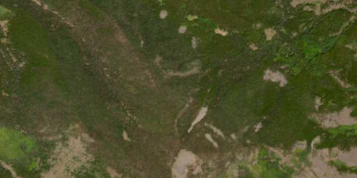
Meteorologists at the National Weather Service office in Pueblo, Colorado , said they were alerted to a previously unwarned tornado by a social media user who shared a satellite image showing what appeared to be a swath of deforestation through the terrain.
The uncommon high-elevation tornado touched down earlier this month on Sawtooth Mountain, a remote peak with an elevation of more than 11,000 feet.
A combination of imagery from the European Union’s Copernicus Sentinel satellite and Doppler radar data was enough for officials to classify the event as a tornado .
Because of its rural location and roughly two miles from the nearest roadway, a NWS survey team will not visit the damage site, and the twister will retain an "unknown" rating on the tornado scale.
PHOTOS: RARE UTAH TORNADO

 ClickOrlando
 The Register-Guard
 KPTV Fox 12 Oregon
 KXLY 4 News
 WBTV Mecklenburg County
 KSEE24 News
 KGNS
KGNS Space War