
 WKYT
WKYT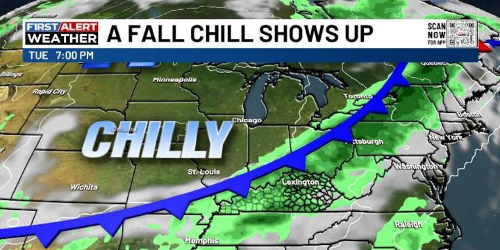
LEXINGTON, Ky. (WKYT) - We are rolling into the first weekend of October on a very warm note across the Commonwealth, but some changes are brewing for next week. Those changes mean a true fall cold front slams in here with some much-needed rains and a more typical October feel.
Temps today through the weekend are generally from the upper 70s to the middle 80s.
Scattered showers and storms begin to bubble up on Monday ahead of a cold front dropping in from the northwest Tuesday and Wednesday. That brings additional waves of showers and storms with chilly winds dropping in behind it.
Temps turn below normal for the second half of next week. Can we get it chilly enough for a kiss of frost by Thursday or Friday morning? We would need clear skies to get down to those levels.
Another system

 People Top Story
 New York Post
 WBKO
WBKO Courier Journal
 KTLA
KTLA Raw Story
 TIME
TIME