
 KIMT News 3
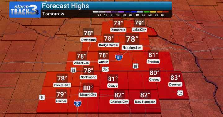
As we look ahead beyond this weekend, it appears we're in for quite a shift in our weather patterns here across southeastern Minnesota and northern Iowa. We're keeping a close eye on some low-end elevated fire weather conditions that could develop for our croplands.
By tomorrow night, we're forecasting a decent chance for showers and perhaps even a few thunderstorms to develop from Sunday afternoon right through Monday night. This system has the potential to bring some heavier downpours, and we'll be monitoring the exact timing and intensity. As we move into the latter half of next week, things could really change, as we're seeing signals for potential frost across central Wisconsin on Wednesday and/or Thursday mornings. This would be a notable shift from typical late-season warmth and co

 Local News in Florida
 Santa Maria Times Safety
 KSNB Local4 Central Nebraska
 The Washington Post
 WRBL News 3
 WYMT
WYMT KNOE
KNOE America News
 AlterNet