
 WEVV 44News
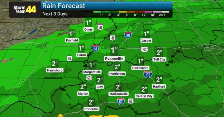
We're tracking an approaching weather system that brings a significant chance for heavy rainfall over the next couple of days, with cumulative totals potentially reaching 1 to 3 inches by Tuesday.
We will be monitoring this closely, as localized amounts could be even higher, particularly over western Kentucky where the flooding risk is most pronounced due to the possibility of 3-plus inch totals in some areas.
This isn't typical weather for us, and any heavy precipitation raises concerns for potential flooding, especially in low-lying or flood-prone areas.
The good news is that this system is expected to move out by Wednesday, allowing a return to drier conditions and more seasonal temperatures. As this system clears, we anticipate a pleasant shift with cooler, drier air settling in.
L

 GV Wire
 Eyewitness News 3
 Battle Creek Enquirer
 KY3
KY3 KOMU 8
 WRCB-TV
 WWSB
WWSB NewsTalk 1280
 WLOX
WLOX Fox 26 Liberty County
 KALB-TV Sports