
 7News Boston WHDH
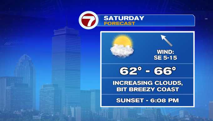
It’s a decent start to our weekend! It will be dry with highs in the mid/upper 60s. We’ll see more clouds compared to the past couple of bright days. It’s great for any fall activities. Tomorrow we’ll start to feel the impacts from our inbound nor’easter. Those impacts include heavy rain, strong wind, minor coastal flooding and beach erosion. The peak of the event will be on Monday. Showers and breezy conditions linger into Tuesday.
Let’s talk about the setup. Low pressure has developed off the southeast coast. It’s associated with the rain showers you’re seeing on radar along the Carolina coast. Meanwhile, some energy near Canada and New York will merge with this area and help to strengthen our future storm. A strong pressure gradient sets up between the low and a Canadian high that will

 America News
 NBC News Video
 Post Register
 KSNB Local4 Central Nebraska
 The Fayetteville Observer
 WBRC
WBRC CBS Los Angeles
 Raw Story