
 7News Boston WHDH
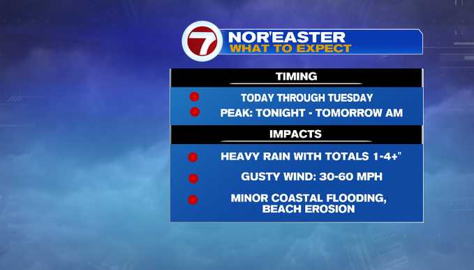
We start to feel the impacts of a nor’easter today! Rain fills in south to north. The wind picks up too. The storm lingers through Tuesday. Although, the peak of the event will be tonight through tomorrow morning.
Radar and satellite below shows our weather setup. The area of low pressure that is our coastal storm is off the Carolina coast. There’s been rain and ongoing flash flooding for South Carolina this morning. Meanwhile, the precipitation shield extends to the Islands. As of this blog writing, showers have overspread Nantucket. High pressure north of the Canadian Maritimes will interact with this coastal low. It will drive up the pressure gradient increasing our northeast wind. That’s the reason gusty wind will be one of the impacts over the next couple of days.
Rain will fill in

 NECN Providence
 The Boston Globe Crime
 The Babylon Bee
 The Motley Fool
 Fit&Well
 Raw Story
 Cover Media
 America News