
 KTLA
KTLA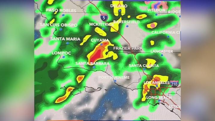
An early season storm is expected to move through Southern California late Monday through Tuesday, prompting flashflood watches for recent burn scars, according to the National Weather Service.
The storm system, approaching from the Pacific Northwest, was expected to bring gusty winds to Santa Barbara County as early as Sunday night as it tracks southward through Tuesday morning and then shifts eastward.
“This cold and dynamic system will bring increasing south winds to much of the area, unseasonably low snow levels around 6,000 feet, rainfall totals ranging from 0.75 inch to 3.5 inches, and widespread thunderstorm chances,” NWS reported. “There is a risk of strong thunderstorms developing at times, with heavy downpours, strong gusty winds and hail.” • Radar models for a "significant O

 America News
 NBC News Video
 Post Register
 CBS Los Angeles
 KSNB Local4 Central Nebraska
 The Fayetteville Observer
 WBRC
WBRC The List
 Oh No They Didn't
 Breitbart News