
 KIMT News 3
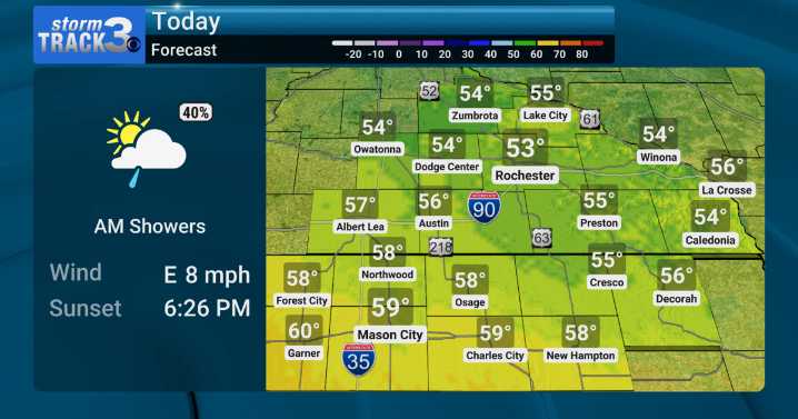
(KIMT) -- Our Hump Day forecast will be pretty similar to Tuesday in that clouds will hold tough, easterly winds will continue to blow, and high temperatures will remain stubborn in the 50s.
The main difference will be a lack of widespread rain. Lingering morning showers could persist into the afternoon as a low-hanging cloud deck produces this precipitation. Low-end rain chances continue to plague SE Minnesota and North Iowa through Friday.
Thursday and Friday will feature a decent warm-up as south winds strengthen. Expect highs to reach for the upper 60s to low 70s Thursday and the low to mid 70s Friday ahead of a passing cold front.
This cold front could spark a few rumbles of thunder along the boundary late Friday, but no severe weather is expected. After the front, northwesterly wi

 America News
 Hattiesburg American
 FOX 10 Phoenix Latest
 The Weather Channel
 WSAZ NewsChannel 3
 KPLC
KPLC WCNC Charlotte Weather
 New Jersey News
 Raw Story