
 KFVS12
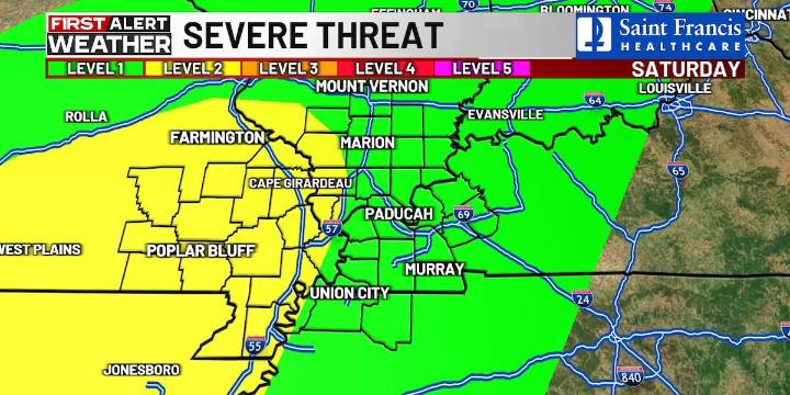
(KFVS) - The rest of the work week will be warm and calm, but big changes are on the way with an approaching strong cold front.
Afternoon highs today and on Friday will be in the mid-80s with overnight lows in the upper 50s to low 60s.
A strong cold front is set to arrive on Saturday.
This will increase the potential for showers and storms.
Models right now show a complex of storms moving across the Heartland late in the afternoon into Saturday evening.
Some storms could be strong to severe.
IF this complex develops, damaging winds will be the primary concern with an isolated spin-up tornado threat.
Half of the Heartland right now is outlooked at a threat level 2 out of 5 for severe storms.
There continues to be a lot of uncertainty with the timing and details.
Stay tuned with you

 FOX 5 Atlanta Crime
 FOX 32 Chicago
 WAFB
WAFB KPLC
KPLC KTVU San Francisco
 KSNB Local4 Central Nebraska
 WOWT
WOWT Fox 26 Liberty County
 The Bay City Times
 Raw Story