
 Space.com
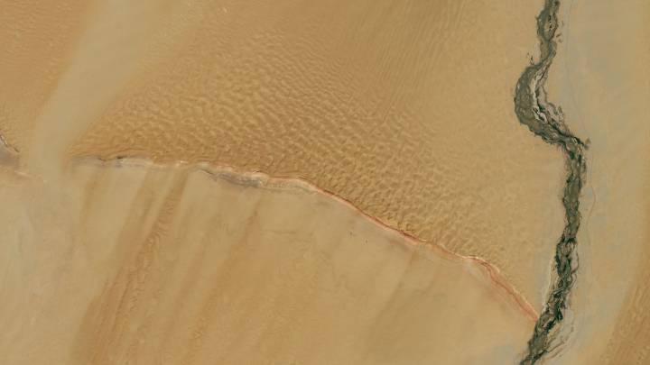
Seen from space, western China's Tarim Basin shows the importance of waterways. The image, taken by the OLI-2 (Operational Land Imager-2) instrument on the Landsat-9 satellite, captures the geological and environmental crossroads where desert winds and glacial meltwater converge.
What is it?
Launched in 2021 as part of a long legacy of Earth-observing satellites, Landsat 9 is a joint mission of NASA and the U.S. Geological Survey (USGS). The satellite is equipped with state-of-the-art sensors. It captures high-resolution images in both visible and infrared light, allowing scientists to track environmental changes across continents, from shrinking glaciers and shifting coastlines to urban expansion and desert dynamics.
In this image, Landsat 9 reveals the Mazartagh Ridge rising around 60

 Newsweek Top
 WAND TV
 IFL Science
 New York Post
 NBA
NBA America News