
 ABC4 News
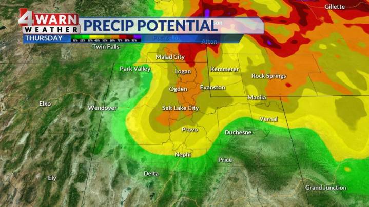
SALT LAKE CITY (ABC4) — Happy Thursday, Utah! At this point in the month, Salt Lake City has broken the record for the "wettest October on record," with more precipitation today. This soggy system is on its way out today, but the counterclockwise rotation will bring wrap-around moisture to northern Utah.
Heading into early Thursday morning, a NW flow will allow for unsettled conditions and scattered showers to stick around. The NW flow will also allow for some lake enhancement keeping wet weather churning into the early afternoon and temperatures significantly cooler than average. With the dropping temperatures also comes dropping snow levels. Snow is expected above 7000 feet with accumulations between four to eight inches expected at the highest peaks of the Wasatch and Uinta mountains.

 KSL 5 TV
 FOX 13 News
 Axios
Axios Raw Story
 Bored Panda
 TODAY Pop Culture
 People Top Story
 NBC10 Boston Entertainment
 The Daily Beast