
After a wet and windy end to the weekend we're starting off the work week with sunshine and calmer conditions. Expect highs in the mid 60s Monday, a spectacular fall day with slightly below normal highs. A dry cold front tracks through Tuesday, firing up a gusty (20 to 30 mph) west/northwest wind. Highs will top out in the upper 60s with mostly sunny skies. After it passes, the coldest air of the season filters in with Wednesday, we'll only make it to the upper 50s to low 60s. Thursday and Friday morning's lows will drop to the mid to upper 30s. Frost is possible both mornings, if you have any cold sensitive plants hanging on take the necessary precautions to protect them.
Sunshine Returns and the Wind Briefly Backs Off Monday
 LEX 18 News5 hrs ago
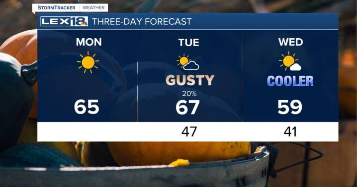
8

 WLKY
WLKY CBS Minnesota News
 America News
 FOX 10 Phoenix Latest
 FOX 32 Chicago
 WRCB-TV
 The Oregonian Public Safety
 WSIL-TV
 WNDU
WNDU WCBI-TV
 NBC Connecticut
 NBC12
NBC12 Raw Story