
 ABC4 News
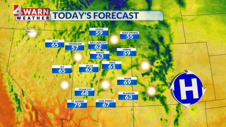
SALT LAKE CITY (ABC4) — Happy Tuesday, Utah! Our Tuesday afternoon will feature mostly sunny skies with our temperatures rebounding back into the 60s for northern Utah and upper 70s for SW Utah.
A cut-off low pressure will move across southern Utah Wednesday, bringing isolated showers for areas along and south of I-70. We could see a few renegade showers push up near the I-80 corridor Wednesday night into Thursday morning before the system exits the state by Wednesday afternoon. Rainfall amounts look to be fairly light on average with less than a 0.25" for most locations.
The end of the work week, moving into the upcoming weekend will feature sunshine and average temperatures. Highs will be in the 60s for northern Utah, with highs in the mid 70s for SW Utah.
A more potent storm system m
