
 cleveland.com
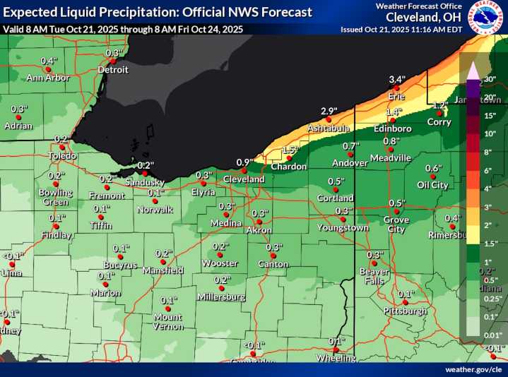
CLEVELAND, Ohio — Northeast Ohio will see an unsettled stretch of weather through midweek as a low-pressure system stalls over the Great Lakes, keeping showers, clouds and cooler temperatures in place.
A cold front swept through the region Tuesday morning, bringing pockets of rain for the morning commute. In its wake, partial clearing and breaks of sun are possible for a time during the afternoon before another wave of precipitation redevelops later in the day as colder air aloft arrives over the Great Lakes.
It will be breezy Tuesday, with gusts between 20 and 30 mph possible. The winds will be strongest near the lakeshore, forecasters noted.
A few isolated thunderstorms can’t be ruled out late this afternoon or evening, and the strongest showers could produce locally higher gusts appr

 WFMJ-TV Politics
 Associated Press Top News
 Esquire
 The Daily Beast
 FOX News Videos
 America News
 Billboard
 The Columbian Sports