
 ABC4 News
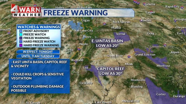
SALT LAKE CITY (ABC4) — Happy Tuesday, Utah! It'll be a chilly start to the day with valleys bottoming out in the upper 20s to low 30s, bringing a chance of freezing temperatures from the Wasatch Front to Cedar City.
Mountain valleys and the Wasatch Back will have lows in the upper teens to low 20s, so bundle up on your way out! A Freeze Warning will be in effect until 9 am for Capitol Reef/Vicinity where temperatures should fall to about 30°, and the eastern Uinta Basin where we could see temps drop to 20°.
Temperatures will run below average in the north with daytime highs in the upper 40s to low 50s, while the south stays a little warmer topping out in the mid 50s to low 60s. The St. George area will climb into the low and mid 70s. • 4Warn Weather • 4Warn Weather • 4Warn Weather

 Local News in New York
 WAND TV
 WWSB
WWSB FOX 13 Tampa Bay Crime
 Reuters US Top
 AlterNet
 The Columbian Politics
 Associated Press US News