
 Hawaii News Now
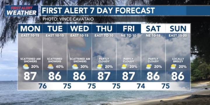
HONOLULU (HawaiiNewsNow) - A rapidly weakening cold front will begin drifting westward and away from the islands, reducing the threat of heavy rainfall for Kauai and Oahu.
An upper disturbance accompanying the frontal boundary is also drifting westward, but it will continue to enhance showers for windward areas of all islands through early Tuesday.
Looking ahead, we have a First Alert for another cold front that could bring another spell of wetter weather statewide. It’s still too early to tell for sure, but we’ll keep you posted.
A high surf advisory will remain posted overnight for the north and west shores of most of the smaller islands. Waves are expected to decline just below the advisory threshold by daybreak Monday.
Some overhead sets may be possible for east shores from a north

 WITN-TV
 Northern News Now
 WHAS 11
 KNOE
KNOE KTVU San Francisco
 KSNB Local4 Central Nebraska
 Battle Creek Enquirer
 The Bay City Times
 Courier Journal
 WILX News 10
 Raw Story