
 WAAY TV
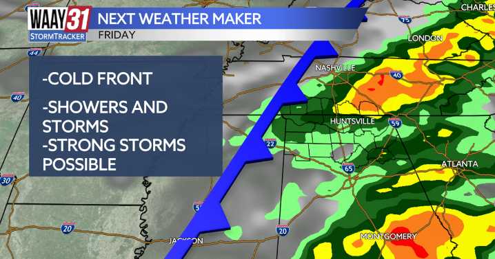
Our next weather maker will move in this Friday bringing with it showers and storms, some of the storms could be on the stronger side with gusty winds being the main threat. After the front temperatures will drop to the coldest we have seen all season.
Tonight will be another calm and cool night with lows in the middle 40s. Thursday will be another nice and warm day, with high temperatures in the mid-70s.
Friday brings the next round of storms. This all looks to move in during the evening and early overnight. Most of us are in a level 1/5 severe weather risk for Friday evening, The Shoals and Southern Tennessee are in a level 2/5 risk. Gusty winds will be the main threat with the storms as they move through.
For the weekend, Saturday will be our last warm day with highs around 70. Anoth

 Eyewitness News 3
 Gothamist
 KSL Utah
 KSLA News
 AccuWeather Severe Weather
 Timeout New York
 CBS Sacramento Dixon News
 KPTV Fox 12 Oregon
 New York Post
 MyNorthwest
 Raw Story