By Joe Lombardi From Daily Voice
A powerful storm system will rattle the East Coast with a dramatic dose of Arctic air, promising raw winds, drenching showers, and a sharp temperature drop for tens of millions.
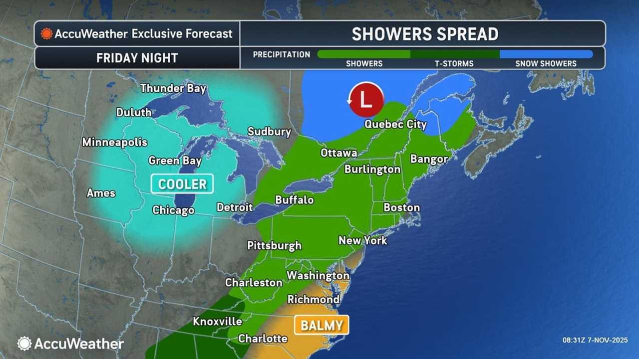
The system is set to unleash widespread rain showers along and ahead of a fast-approaching cold front Friday night, Nov. 7, layering the region with gusty winds and even a few rumbles of thunder overnight, the National Weather Service says.
High pressure will keep things dry at first, but clouds are expected to thicken as the evening progresses, ushering in a wave of showers sweeping east Friday evening.
AccuWeather meteorologists warn that the event will lead to “travel disruptions and significant weather swings as warm and cold air masses collide.”
By Saturday, Nov. 8, dry conditions will briefly return, but the reprieve will be short-lived as the true chill settles in.
A blast of Arctic air will surge in from central Canada, riding a pronounced jet stream dip and expanding southward across the Plains, Mississippi Valley, and eventually invading the Northeast and Southeast by early next week.
AccuWeather forecasters note that this cold surge will send temperatures plunging 15 to 25 degrees below normal.
The cold snap is expected to end the growing season in parts of the South and usher in the first snow of the season for parts of the Northeast.
Lake-effect snow will develop as colder air crosses the Great Lakes from Sunday night, Nov. 9, into Tuesday, Nov. 11, setting off sudden, intense squalls from the Midwest into Pennsylvania and western and central New York.
“Brief but intense snow squalls could cause multi-vehicle accidents, while snow and slush may trigger regional airline delays from deicing operations,” AccuWeather says.
Even limited snow accumulation could disrupt transportation and pose safety risks along critical travel and business routes throughout the Great Lakes and interior Northeast.
Check back to Daily Voice for updates.

 Daily Voice

 NBC News
 New Hampshire Union Leader
 Raw Story
 New York Post
 7 News WKBW
 Secret NYC Top
 US Magazine