
 21Alive News
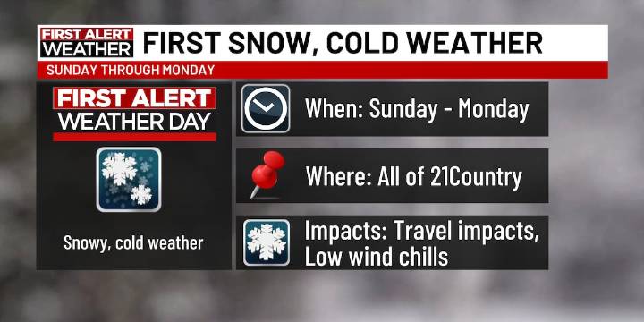
FORT WAYNE, Ind. (WPTA) - Much of your Saturday is expected to be dry with high temperatures in the upper 40s and low 50s, but Saturday night will be the start of a relatively short-lived weather pattern change.
We’ve issued First Alert Weather Days for Sunday and Monday because of the possible impacts the snow will bring. Those impacts will include isolated slick spots Sunday morning through Monday night, reduced visibility at times, as well as wind chills down in the 10s on Monday morning .
The weather system starts as rain overnight Saturday into Sunday, but then transitions to a rain/snow mix on Sunday early morning, becoming just snow on Sunday afternoon. Sunday evening through Monday evening, lake effect snow will drift in and out of our area. Due to the warm ground, most s

 WSAZ NewsChannel 3
 WBRC
WBRC WSMV 4 Nashville
 Newsday
 WAND TV
 WTHR Crime
 CBS Sacramento Dixon News
 The Journal Gazette
 WTHR
WTHR CNN
CNN @MSNBC Video