
 WSIL-TV
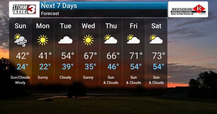
We're monitoring a sharp cold front that's set to make its approach and passage this evening and into tonight. While the chance is small – just 5% – we are keeping an eye out for any potential storms that might develop along this front, bringing with them the possibility of strong, gusty winds.
However, the primary story with this mostly dry front will be the arrival of our first real taste of cold air to kick off the new week. We can expect those morning temperatures to plummet, with values falling into the teens and 20s from Sunday through Tuesday. By day, temperatures only climb into the low to mid 40s. With this much colder air in place, we can't rule out a few flurries or very light snow showers during that time.
As the week progresses and atmospheric heights rise again by mid-week,

 WCNC Charlotte
 KIMT News 3
 WREX
WREX WISC-TV Channel 3000
 FOX 10 Phoenix Latest
 WMTV NBC15
 KNOE
KNOE KSNB Local4 Central Nebraska
 WESH 2 News
 WNNY-TV
 FOX Weather
 Hawaii News Now
 13 On Your Side