
 WAAY TV
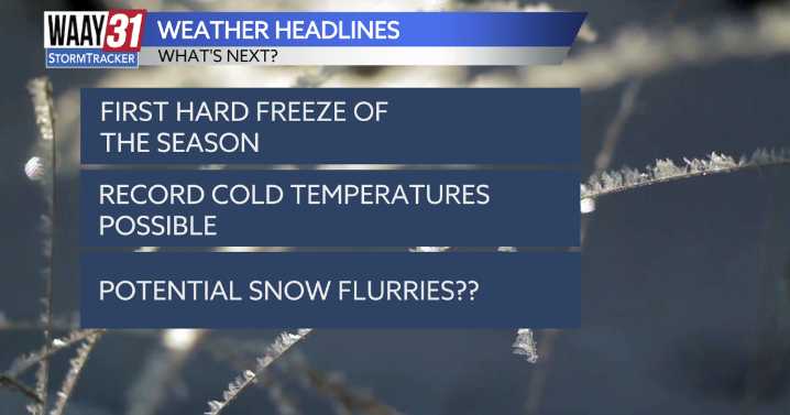
Our next weather maker arrives Sunday, bringing the coldest air of the season—along with our first hard freeze, record cold temperatures, and the potential for snow flurries.
Tonight will be the last mild night for the next few days, with overnight lows dropping into the low 50s.
Sunday morning will start off mild, eventually warming to the upper 50s around lunchtime. Temperatures will then begin to drop as a strong cold front pushes through. By the afternoon, readings will be in the mid-40s, with wind gusts up to 30 mph possible. Snow flurries are possible over Sand Mountain tomorrow evening around dinnertime, as lows fall into the upper 20s.
Monday morning temperatures will be below freezing—around the upper 20s—with wind chills in the upper teens to low 20s. Highs will only reach aro

 KLFY News 10
 El Paso Times
 News4JAX
 WISC-TV Channel 3000
 WKOW 27
 WMTV NBC15
 WCTV
WCTV News Channel 36
 KNOE
KNOE FOX 10 Phoenix Latest
 FOX 32 Chicago
 FOX Weather
 Hawaii News Now
 ESPN Cricket Headlines