
 WHAS 11
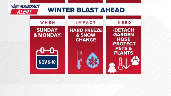
KENTUCKY, USA — Alright snow and cold weather lovers across Kentuckiana this is what you've been waiting all summer to hear! We have been tracking a blast of winter weather that will be moving into the region that will be bringing measured temperatures down into the 20s and wind chills in the teens to start the workweek and yes, some snow will be possible.
Sunday will see an upper level trough dive into the Ohio Valley bringing with it a significantly colder air mass. With it, rain and snow will come but as we have been saying up to this point, nothing major in terms of impacts are expected. We will discuss *possible* snow accumulations later on in this writing.
Credit: WHAS11
Sunday will start off at its warmest with temperatures in the mid to upper 40s. The 40s look to stick around in

 WISC-TV Channel 3000
 WKOW 27
 WMTV NBC15
 WCTV
WCTV News Channel 36
 KNOE
KNOE FOX 10 Phoenix Latest
 Hawaii News Now
 KIMT News 3
 FOX Weather
 Winnipeg Free Press World