
 WVLT
WVLT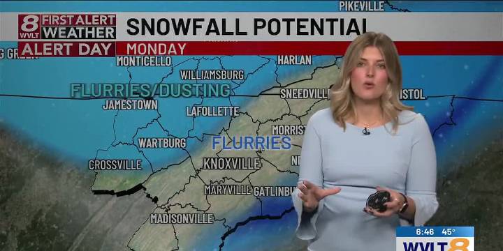
KNOXVILLE, Tenn. (WVLT) - Extreme cold, brutal wind chills, and even snow are all on the table as an Arctic Blast works through East TN.
TONIGHT: Snow showers will build across the mountains as well as the Cumberland Plateau with clouds locked in place. Temperatures will continue to drop into the upper 20s.
FIRST ALERT WEATHER DAY MONDAY: You will need to pull out the gloves, boggin, and heavy winter coat Monday. Temperatures will start out in the morning in the upper 20s and will reach the upper 30s by the afternoon. But due to the strong gusty winds, it’ll feel like the teens and twenties all day long.
Round 2 for snow comes Monday afternoon and into the evening hours. Once again, the best chance for snow accumulation will be in the mountains; however, a few flurries in the valle

 WSIL-TV
 KNOE
KNOE FOX Weather
 WBRC
WBRC Hawaii News Now
 The Bay City Times
 KOLO8
KOLO8 NECN Providence
 CBS News
 WCBI-TV
 The Conversation