
 CBS Philly
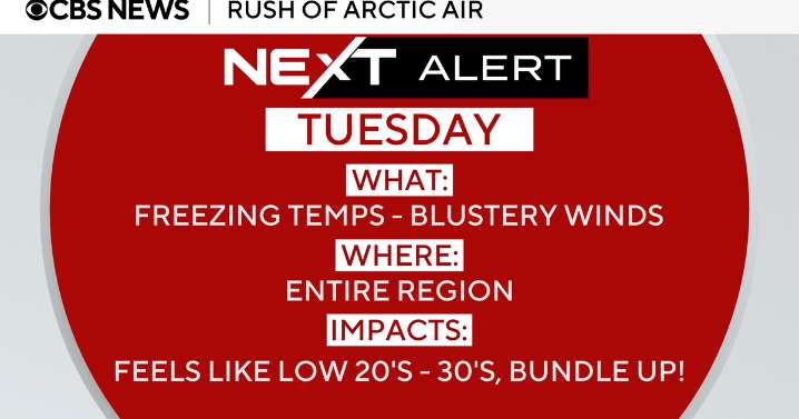
Monday is what we call a "transition day" in weather speak, also known as an upside-down day. This generally refers to a day marked by strong cold air advection, where you hit the high temperature in the morning and then temps progressively plummet. We were in the mid-50s early this morning, and by midnight, we will likely be in the mid-30s.
This is notable because if you simply check a phone app and see that today's high is 54, it doesn't alert you to the fact that, well, that temperature has already happened. By late this afternoon, when we generally would hit a daytime high, we'll be dropping into the 40s, and with the winds picking up, it will feel like the 30s.
A NEXT Weather alert is in effect because of the cold conditions on Tuesday. Here's what to expect around the region:
Phil

 Daily Voice
 Delaware County Daily Times
 People Human Interest
 Screen Rant
 Los Angeles Times Opinion
 Raw Story