
 KIMT News 3
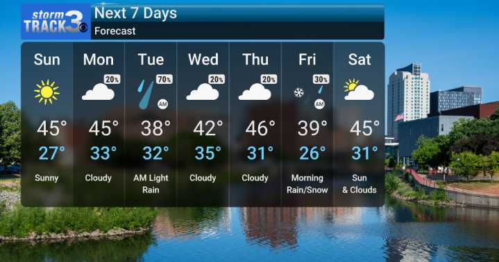
While we've been enjoying some warmer-than-normal temperatures lately, that pattern is set to shift. Tomorrow it's back to highs in the 40s. Wind should ease, but with a very dry airmass nosing in, the risk of fire spread is elevated.
Otherwise, there's a chance for precipitation starting Monday afternoon and continuing into Tuesday. Our team is monitoring models that suggest a mixed bag of rain and snow is possible, although mixing looks more likely north. Will also watch for any ice, but again right now that risk does not look big.
Beyond Tuesday, we'll dry out for a bit, but more chances for rain showers are on the horizon later in the week with an active pattern.

 Daily Voice
 WREX
WREX Fox 11 Los Angeles Sports
 WABI
WABI Northern News Now
 FOX 26 Texas
 13 On Your Side
 Lehigh Valley Live
 Batavia Daily News
 The List