
 KWWL
KWWL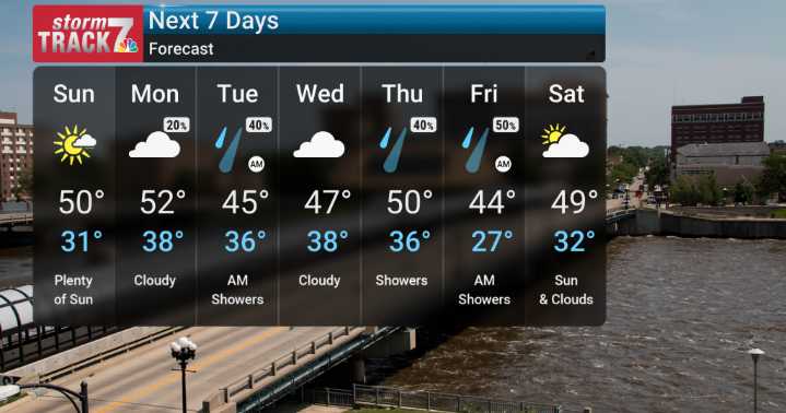
It's been quite the breezy Saturday here as we wrap up the day. As we move into the overnight hours, we expect those winds to calm down significantly. Looking ahead to Sunday, we're anticipating a transition to cooler and calmer conditions under high pressure. While Sunday itself looks to be mostly fair with partly cloudy skies and mild temperatures in the 40s and 50s, it will be noticeably cooler than today.
The real story for the upcoming week begins late Monday. We're tracking an approaching system that will bring chances for rain back to our area, especially for our neighbors to the north and east. For most of us, this will start as rain, keeping us from seeing any wintry precipitation, though far northern Iowa might flirt with a wintry mix. A particularly interesting aspect we'll be

 WBRC
WBRC KTIV News 4
 Daily Voice
 KPTV Fox 12 Oregon
 NECN Providence
 WTOP
WTOP WRCB-TV
 The Bay City Times
 13 On Your Side
 WABI
WABI WCNC Charlotte Weather
 The Texas Tribune Crime