
 WKYT
WKYT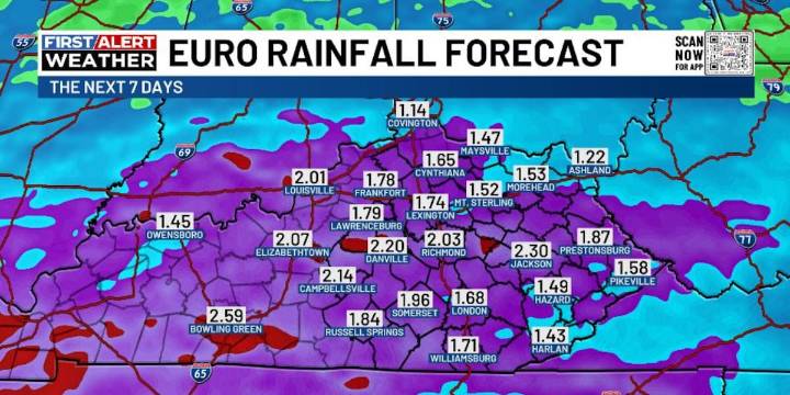
LEXINGTON, Ky. (WKYT) - A slow-moving boundary continues to hang out across the region today and this will be the focal point for more heavy rain in the days ahead. This active pattern will lead us into a big change to Winter as we go into Thanksgiving Week and Weekend.
Lots of low clouds and some fog will likely be common for much of the day with areas of drizzle or a light shower. Temps across the northern half of the state stay in the 40s with 60-65 in the far south and southwest.
This similar temperature boundary hangs around for Thursday as a stalled front starts to get active again. Low pressure develops to our west and rolls eastward along the front Friday into early Saturday. That means additional waves of heavy rain producing showers and some thunder.
This has all the makings o

 America News
 The radio station 99.5 The Apple
 New York Post
 AlterNet
 Times Herald-Record
 KLCC
KLCC The Poughkeepsie Journal
 The Journal Gazette
 OK Magazine