
 Manchester Evening News
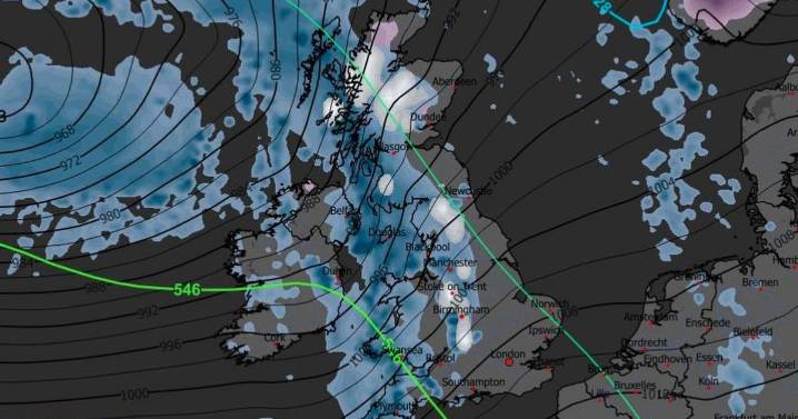
View 2 Images
Weather maps have revealed the exact date more snow could hit the UK amid another Arctic blast.
Some areas across the UK could see up to seven inches of snowfall as a band of freezing low pressure sweeps across the UK from the northwest. After a rise in temperatures since last week's freezing cold snap, the mercury is set to drop again in early December, the Mirror reports.
Metdesk forecasters and the WX Chart suggest the next period of snowfall in the UK is most likely to be on Saturday, December 6. The snow showers could continue for several days if temperatures remain low.
Weather maps show white hues as far south as the Cotswolds on the morning of December 6, with widespread snow predicted for some time, including in Greater Manchester. The thickest white patches on

 Sunday Express
 Coventry Telegraph
 Liverpool Echo
 Akron Beacon Journal Sports
 Bozeman Daily Chronicle Sports
 ABC30 Fresno Sports
 Reuters US Domestic
 Raw Story
 AlterNet
 The Conversation
 The Daily Beast
 ABC30 Fresno World