
 WREX
WREX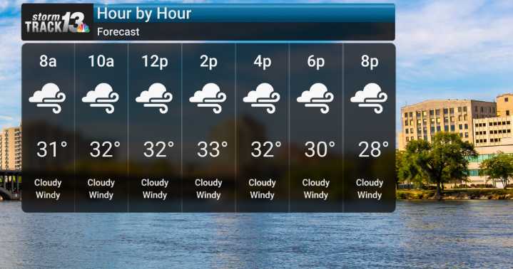
This morning, we've already seen winds increase in speeds, with some gusts exceeding 45 to 50 mph. We expect theses to become quite common today, likely in the 50 to 55 mph range, with the possibility of brief gusts reaching up to 60 mph.
We're on alert for potential power outages or minor property damage. These fierce westerly winds are bringing much colder air along with them, making it feel quite brisk out there, and this blustery, much colder weather will certainly stick around through Thursday evening and into Thanksgiving Day. We'll be looking for wind chills to hover in the teens to low 20s.
On top of the wind and cold, we'll also see some wrap-around snow showers and flurries, particularly north of I-80, as a robust storm system develops further north. While any accumulations tod

 Daily Voice
 Detroit News
 CNN Climate
 AccuWeather Severe Weather
 WMTV NBC15
 The Oregonian Public Safety
 Associated Press US News
 WISC-TV Channel 3000
 FACTS.NET Culture