
 WTVM News Leader 9
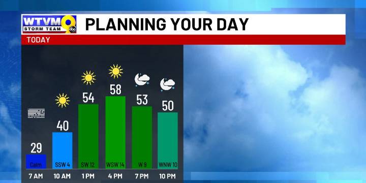
COLUMBUS, Ga. (WTVM) - The sunnier sky sticks around the rest of the workweek with some ups and downs temperature-wise. There could be a few showers over the weekend, but it doesn’t look widespread ahead of a cold snap early next week.
A frosty, fog and freezing cold start Wednesday means you should allow for extra time. The main impact is that it’s difficult to see. However, a few slick spots can’t be ruled out on the bridges and overpasses due to the added moisture in the air. Otherwise, sunny for most of the day. Turning breezy and warmer during the afternoon. Highs in the upper 50s north, near 60 degrees in Columbus and Phenix City and low 60s south.
Some clouds Wednesday night as a cold front comes. Chilly with lows early Thursday mostly in the mid 30s.
Mostly sunny Thursday. Highs

 11Alive Crime
 Atlanta News First
 WRDW-TV News 12 Crime
 11Alive Atlanta
 WTOC 11
 WCTV
WCTV Savannah Morning News